Tag Archives: Greenodd

Cleared byway from Greenodd to A590 underbridge

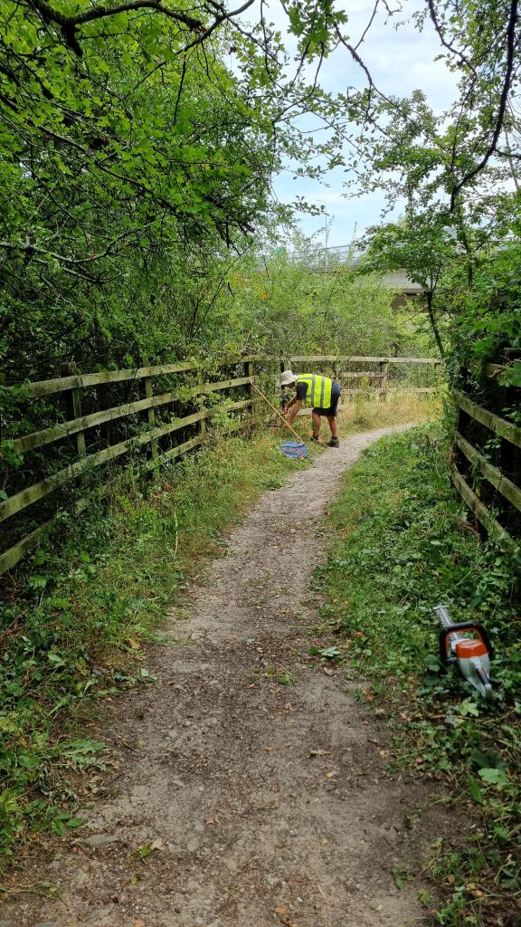
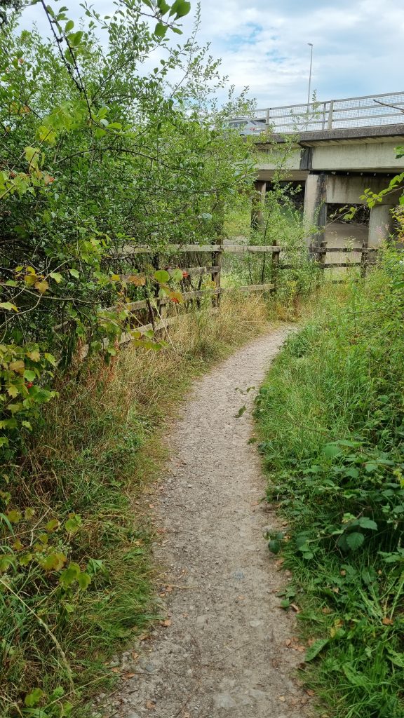
This short but useful path (actually a byway – BOAT 522017) goes from the southern end of Greenodd main street to the river Crake, where you can turn right to get under the A590 and so get to the footbridge over the river Leven to the Holker side. Our council contacts had asked us to do some clearing after someone reported it as needing attention.

So volunteers MS, CH, SH and PQ went and used hedge trimmers to cut back the vegetation that was starting to encroach the most.

BEFORE:

AFTER:

Stiles fixed: Smithy Green, Greenodd

Two stiles needed fixing on the short path from Smithy Green Farm to the lane above Penny Bridge Church. PathFix volunteers TL & GC rebuilt both steps on one and repaired the step on another.

Stile 1 BEFORE:
The rails and uprights were secure on this stile, but both steps were rotted and at least one step support post was in danger of collapsing.

Stile 1 AFTER:
It is now secure and fully usable, after PathFix volunteers TL & GC replaced both steps and all their support posts.

Stile 2 BEFORE:
The old steps were rotting on the stile at the other end of that path, where it leaves the wood onto the lane above Penny Bridge Church.

Stile 2 AFTER:
So they replaced both steps on that stile.

Survey of path from Smithy Green Farm (near Greenodd)

Survey by PQ on 19 April 2025:

Map

This is a short section of path near Greenodd, just a few hundred metres long, that starts from a minor lane just south-west of Smithy Green Farm. It goes through the farm and one of its fields before crossing a part-broken wooden stile into a small wood, at the end of which there is another part-broken wooden stile that leads onto the lane just south of St. Mary’s Church above Penny Bridge.

Problem 1: There is no fingerpost or waymark where it sets off from the lane along the farm access track.

Problem 2: At the farm there is no waymark to show which way to go.

The path actually goes through this gate, which is easy to open and then turns left once in the field 20m further on.

The path leaves the field at the far left corner, where there is a broken and part-overgrown stile into the wood beyond.

Problem 3: Although the rails and uprights on this stile are secure, both steps are part rotted and need replacing, and the upper step’s support post on this field side of the stile is loose in the ground and in danger of collapsing (the step support post on the left in first photo).

The second photo is from the other (small wood) side of the stile, looking back over the stile at the farm. The step supports on this side are still firm, but both steps are damaged and need replacing.

Problem 4: just beyond that stile the ground drops down a steep gravelly bank into the wood. This drop is a bit dangerous and it would be very useful if it were stepped to avoid the risk of someone falling.

Problem 5: The small wood is quite attractive, with bluebells and garlic, but the route through it is unclear and there are fallen trees blocking some apparent paths. So some simple path clearing and marking would be useful.

At the end of the wood the path goes over another wooden stile, onto the lane just south of St. Mary’s Church above Penny Bridge .

Problem 6: The lower step on this stile is part broken and needs replacing (the step support posts still seem firm). But also, there is nothing to hold onto when on the upper step (left hand side in photo, which is fro the lane side) since the finger post is too far to reach from there. So a second tall upright hand-hold post on the left (when viewed from the lane) would be useful and make it safer.

The second photo here shows the lower step, which is part-broken on the wood side of the stile.
Survey of Low Scathwaite – Toppin Rays (near Greenodd)

Survey by PQ on 19th April 2025:

Map

I surveyed this path from the Toppin Rays end, where is leaves the lane just north of Toppin Rays Farm, from where it rises over the hill to Low Scathwaite. The finger post where It leaves the lane (up a farm track) has half its finger missing, but it’s still just about readable as saying “Public Footpath”.

At the end of the track it reaches a field gate with a pedestrian gate at the side. This pedestrian gate opens reasobaly easily, but it has dropped a little and now catches against the top of the central metal gatepost and needs a bit of force to get it to open and close.

After that the path climbs over a hill and drops down to a ladder stile over a dry stone wall, with a metal field gate through the same wall a short distance away.

This ladder stile is badly broken and dangerous. The Toppins Ray (south-east) side of it has a missing step, a step that’s loose on the right and part-rotted side rails. The top platform planks are mostly loose, and the Low Scathwaite side of it has even more missing / loose steps, plus the side rails on that side are even more rotted, so PQ feels this existing ladder stile is beyond repair and dangerous. The best temporary solution would be to remove the ladder stile and put waymark signs on the field gate, which is openable and needs to be kept that way. In due course, if the land owner does not want walkers using the field gate, or if diverting the ROW through that gate is deemed unsatisfactory, then a new ladder stile could be erected over the dry stone wall and the waymark signs moved to that new ladder stile.

This is the metal field gate near that dangerous ladder stile.

After that the path passes north of Low Scathwaite Farm to a wooden field gate into a short track that leads to the lane by Low Scathwaite Farm. This wooden gate is very old and hangs from a single top hinge (top left in photo, whioch is viewed from the lane side), so it dangles worryingly when opened and walkers proba bly worry that it is going to fall off or collapse when they open it.