All posts by admin

4 Cumbria Way Fingerposts installed

In August & September PathFix volunteers have installed four new fingerposts on the Cumbria Way (CW) north of Ulverston, as part of our efforts to greatly improve the waymarking of the Cumbria Way. Many thanks to Westmorland & Furness Countryside Access Team for supplying the fingerposts.

Click photos to enlarge.

Two Fingerposts on Old Hall Road

Earlier this year we proposed and coordinated a Cumbria Way route improvement between Gill Banks and Old Hall Farm just north of Ulverston. The new route avoids a steep and eroded climb and also avoids the busy active farmyard at Old Hall Farm. To waymark the new route we have now fitted two new fingerposts.

Where Gill Banks path meets Old Hall Rd (OS Map & Grid Ref): –

This is where the new CW route gets to the end of the attractive Gill Banks track and comes onto the very minor Old Hall Rd lane.

BEFORE: The old fingerpost was starting to rot, but it also needed a new finger for the Cumbria Way.

AFTER: The new post has fingers for all 3 routes – CW south down the Gill Banks path, CW north along Old Hall Road and north-east along the footpath over Flan Hill to Town Bank Road.

Access track to Old Hall Farm fro Old Hall Rd (OS Map & Grid Ref): –

This is where the CW (when heading north) leaves leaves Old Hall Rd and goes down the farm access track and then turns right before the farmyard.

BEFORE: There should have previously been a fingerpost here, since the farm access track is a footpath leaving Old Hall Rd, but it was missing.

AFTER: New fingerpost waymarks both the public footpath and the CW route north and south.

Two fingerposts near Hollowmire Farm

Near Hollowmire Farm (heading north) the CW follows a very minor lane for 250m at Eller Riggs Brow, and new fingerposts were needed where it joined and left this lane: –

Where CW meets lane by Hollowmire Farm (OS Map & Grid Ref): –

Here the old fingerpost had lost one of its fingers and the remaining finger was hard to read. It has now been replaced with a new one that has fingers for walkers going both north and south on the Cumbria Way.

200m north of Hollowmire Farm (OS Map & Grid Ref): –

Here the CW northwards leaves the lane onto a footpath to Osmotherley Church: –

BEFORE: The old fingerpost had rotted at the bottom and collapsed into the long grass. Its top part had later been re-erected but was rather short and had lost one of its fingers.
©Photo courtesy of Cumbria Tourism.

AFTER: Renewed and now has two legible fingers, so caters for CW walkers heading south as well as north.

Lindal – Mascalles path survey

9 Aug 2026: Survey of FP 602022 by volunteer PQ.

This is a useful footpath that leads from the entrance to Wax Lyrical in Lindal-in-Furness (the old Candle Factory) to near the crossroads where Stone Barrow Lane crosses the lane from Dalton to Little Urswick (called Urswick Road as far as that crossroads, Hooks Lane from there to Little Urswick). From there it is a short walk up Stone Barrow Lane to Verstone kennels & cattery, where the ancient Dimples Hole Lane track leads to two footpaths that go either over or around Little Urswick Crags to the middle of Little Urswick.

The path has 3 main problems: –

  • The kissing gate at P4 is damaged beyond repair and very hard to open & close.
  • The step on the wooden step stile at P5 has collapsed.
  • The kissing gate at P6 is a very tight squeeze to get through, plus has barbed wire close to possible hand holds.

Click photos to enlarge.

P1: Kissing gate near where path leaves London Road at Wax Lyrical, Lindal: (OS Map & Grid Ref)

I forgot to check whether there is a fingerpost where this path leaves the actual lane (London Road). But it is only about 30m across the Wax Lyrical car park to this relatively recently installed tall kissing gate, which is next to a tall gate into the field.
The kissing gate is fine and easy to get through. And although it does not have any waymarks on it, it is fairly easy to see from the lane. And there is a two-way waymark on the stile at P2 immediately beyond the kissing gate, it is fairly easy to see which way to go.

P2: Branch path (OS Map & Grid Ref):

This wooden stile is immediately after the kissing gate, but the Mascalles path being surveyed (FP 602022) does not go over it – instead it continues past it along the edge of the field – since this stile is just the start of path FP 580035, which branches off left and goes to the junction of Halier How Lane and Stone Barrow Lane.
The stile is firm and in good condition and has clear recently -itted new waymarks on both sides, and the ones on the Mascalles path side make it fairly clear that the path to Mascalles goes straight on past it, not over it.

P3: Old Kissing gate into next field: (OS Map & Grid Ref):

The only issues here are that I could not see any waymark for people going towards Lindal, plus the hedge and some nettles are starting to encroach so some more trimming would be useful.
This old kissing gate is OK, opens easily and has a reasonable gap. It looks like it is prone to getting overgrown by the hedge, and there were some nettles very close, so it could do with a bit of clearing. But on the survey date it was OK and the hedge looked like it had been trimmed to keep the kissing gate usable.
There is clear recently fitted new waymark on the Lindal side but no waymark visible from the Mascalles side.

P4: Badly damaged hard-to-use kissing gate (OS Map & Grid Ref):

This old kissing gate is a write-off now and is very hard to use. So it needs to be completely replaced.
The gate hinge post is loose in the ground and leaning, so the gate hanging on it is pressed against the ground and is hard to lift in order to move.
It has also lost one of its vertical bars and the pointed end of another one is exposed and sticking up at the top, a little dangerously.
The cage part of the kissing gate is also badly damaged. So all in all this kissing gate is quite hard to use and still leave in a stock-proof state, and the whole structure needs replacing.
There are recently-fitted new waymarks on both sides.

P5: Wooden stile with collapsed step (OS Map & Grid Ref):

This has nice old stone blocks as steps leading up to it on the Lindal side, with a single wooden step to get over the top of the wooden fence, which is quite firm.
But the support post for that wooden step on the far (Mascalles) side has rotted and collapsed and the step is lying on the ground. The Lindal side wooden support post is still in position and is reasonably firm but does wobble a bit.
So this stile needs the wooden step replacing.

Also, I felt that the recently fitted new waymark pointing onward towards Mascalles is a bit ambiguous. It left me unclear as to whether to go left or right of the clump of trees shown in the photo. The correct way is to the right of them, but the next target (the final kissing gate onto the lane) is not visible from here. So I feel it might be worth refitting that waymark to point is a bit more bearing right.

P6: Tight squeeze kissing gate onto lane (OS Map & Grid Ref):

There are several problems at this old kissing gate: –

  • The main problem is that it’s a very tight squeeze to get through.
  • It is also overgrown a bit on one side by the adjacent hedge.
  • Finally, there is a barbed wire strand very close to you on the other side, which is also wrapped round the road-side fingerpost just where you’re likely to get hold to steady yourself.

The reason the gap between the gate and the cage is very tight is partly that the nice old limestone gatepost on which the gate is hinged (right hand side in 1st photo, from lane side, and left hand side in 2nd photo, from field side) has leaned over towards the cage, and as a result the gap round the gate when passing through is very tight – only about 9½” (235mm).
On the other side of that gatepost (left side in 2nd photo) there is a low stone wall and it looks like over the years it has been pushed over a bit by the heavy stones of the adjacent dry stone wall.
When the W&F countryside access officer visited this with me, she suggested that if the adjacent stones are removed it might be possible to pull the gatepost vertical again, then wedge it in on the gate side, and then rebuild the dry stone wall, with a narrow gap between. But I feel that might still not create a big enough gap and the gatepost might need to be moved further away from the cage in order to get a decent gap to get through.

This photo shows the barbed wire strand, which spans acroos the end of wall just behind the limestone gatepost and is wrapped around the fingerpost with barbs sticking out in a dangerous position.

Cleared byway from Greenodd to A590 underbridge

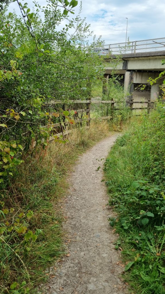
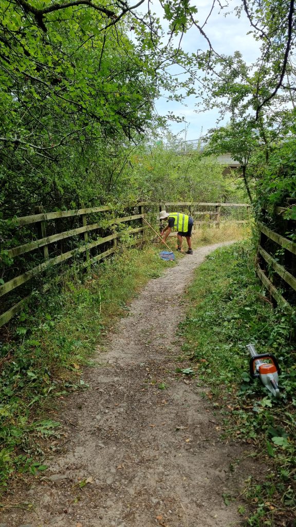
This short but useful path (actually a byway – BOAT 522017) goes from the southern end of Greenodd main street to the river Crake, where you can turn right to get under the A590 and so get to the footbridge over the river Leven to the Holker side. Our council contacts had asked us to do some clearing after someone reported it as needing attention.

So volunteers MS, CH, SH and PQ went and used hedge trimmers to cut back the vegetation that was starting to encroach the most.

BEFORE:

AFTER:

Fixed field & wicket gates near Little Urswick Crags

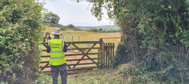
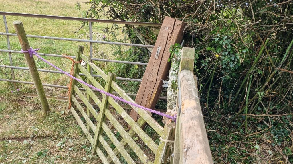
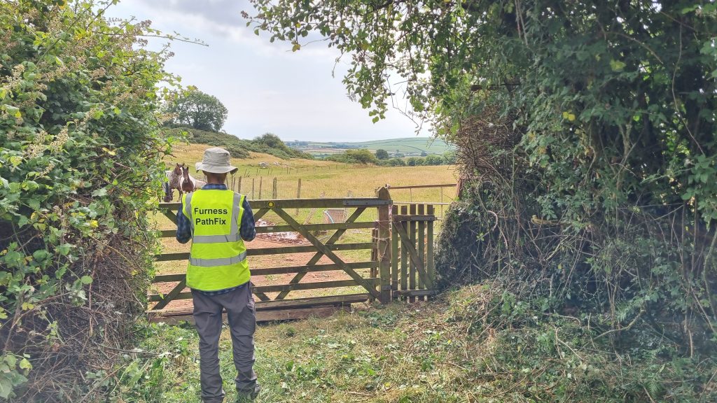
Blockage fixed north-west of Little Urswick, where the path meets Dimples Hole Lane – what a lovely name. This path had become unusable in the last few years, due to a gatepost collapsing. So in July 2026 PathFix volunteers cleared overgrowing vegetation, fitted a new gatepost, rehung the gates and put up new waymarks. (Click photos to enlarge.)

Before:

At the junction where Footpath 580017 meets Bridleway 580018 (Dimples Hole Lane) the gatepost had collapsed and the field gate and wicket gate it supported had had to be tied together and propped up and barricaded a bit, in order to prevent the horses getting out.

PathFix managed to find out who owned the land and get permission to fix things. And the first job was to clear back the hedges either side of the gates, which had run riot a bit and were hindering access.

After:

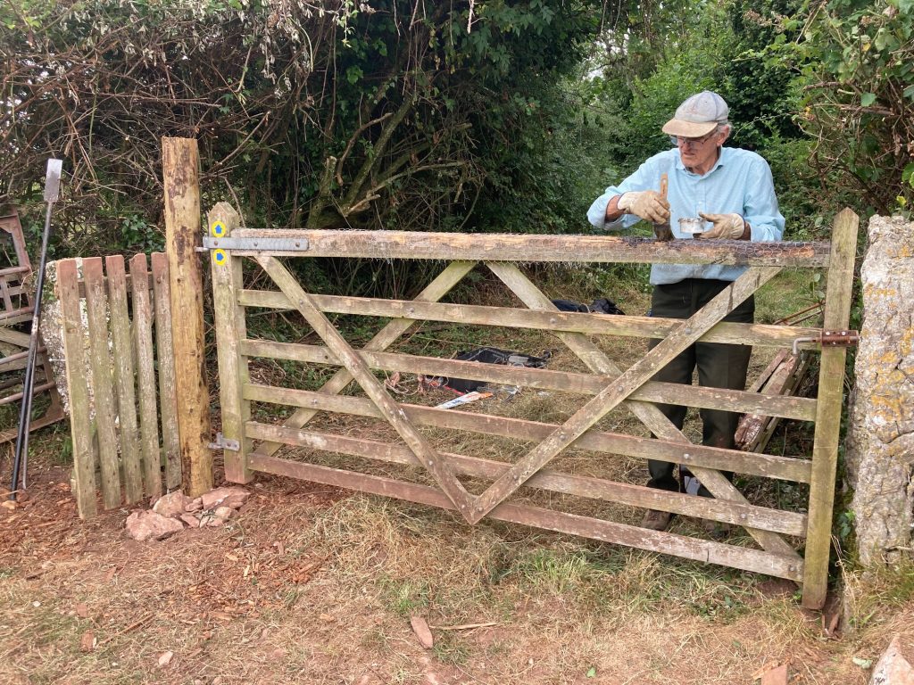
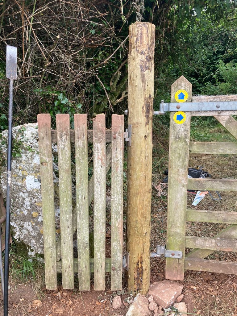
Then this week, our PathFix CWR volunteer team got it sorted. They re-fitted the gatpost and rehung the field gate and the adjacent wicket gate, and and here’s what it looks like now.

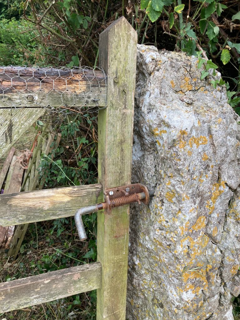
.The field gate had also suffered a bit due to the horses biting on the top bar – do they do this to clean their teeth? So the CWR team also fitted chicken wire over the top rail to stop the horses slowly destroying it.

Many thanks to the volunteers who cleared the area first, to the volunteer who put up the new waymarks (old ones had faded or disappeared). And particularly thanks to the CWR volunteer fixing team who had to get the heavy wood there (it’s 400m from the nearest road) and then get the gatepost installed and the gates rehung. Great work.

Cleared Stiles on Aldingham – Gleaston path

PathFix volunteers CH & partner cleared 3 stiles on the Aldingham to Gleaston Castle path (FP 501020), all of which are now much easier to use after the vegetation was cleared back. (Council Ref: L103814)

BEFORE:
Overgrown stile through hedge.
Grid ref SD 2734 7085.

AFTER:
Now much easier to get over.

BEFORE:
Overgrown bridge through hedges.
Grid ref SD 2722 7094.

AFTER:
That’s better.

BEFORE:
Overgrown gap stile through hedge.
Grid Ref SD 2697 7093.

AFTER:
Can get through now without fighting the hedge.

Four stiles fixed on Haematite Trail near Stainton

PathFix volunteers cleared one stile and re-built three more, all on the short footpath between Greystone Lane and Long Stainton just south of Stainton (FP 602011) needed sorting.

PathFix volunteers LM, SB & SB first surveyed that short section of the Haematitie Trail and also cleared the vegetation that was blocking the gap stile where it leaves Greystone Lane.

Then later, the CWR PathFix volunteer team fixed the other three stiles – all wooden stile – one of which was missing altogether and two of which needed repairs. They also fitted new waymarks.

This is one of the stiles worked on. There was no stile left through this hedge – just one stone that looked like there might at one time been a gap stile there.

So the CWR volunteer team opened up a gap thrugh the hedge and built this new wooden stile there.

Pennington area paths surveys

August 2025: Surveys of 3 paths by volunteers MC & PQ:

We surveyed 3 paths after the council countryside access team asked us to look at some problems that had been reported. See this map and the following survey reports: –

These are useful paths that can be linked to form a nice walking route between Lindal and Ulverston on the north-west side of the A590. But at the time of survey they had significant problems, aome of which PathFix has since worked on.